Sea-level rise threatens low-lying areas around the world’s coasts with increased coastal flooding during extreme sea level events during storms. One response to this challenge is to build or upgrade coastal flood defences as exemplified by the Netherlands, New Orleans or much of the Chinese coast. In this paper the authors examine the potential investment costs of such an adaptation strategy applied globally over the 21st Century for sea-level rise scenarios consistent with the RCP2.6 and RCP8.5 emissions and the SSP2 socio-economic scenarios. Results are reported at the scale of World Bank Regions and the globe. This considers several contrasting scenarios of protection strategies as defined below. The DIVA model framework for coastal analysis is used to perform the analysis.


Feasibility assessment has been conducted in order to make a decision for investment on transportation infrastructure in Korea. With respect to the feasibility assessment, the Ministry of Finance has conducted a pre-feasibility study and the Ministry of Land, Infrastructure and Transportation has implemented a feasibility evaluation. However, the methodology for real application in consideration of deep uncertainty has been limited to a sensitivity analysis and scenario evaluation. In this regard, the Korea Transport Institute (KOTI), which is under the Prime Minister’s Office, is currently conducting a case study in order to come up with a practical methodology for DMU techniques application. As the outcome of this process, KOTI has developed suitable DMU techniques for Korea and applied them to the past case on that basis. With definition of uncertainties on transportation infrastructure, KOTI is planning to present implications and limitations, and explain the efforts that should be implemented in order to apply them in Korea in the future.

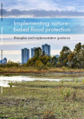
Effective flood risk management is critical to protect people and their livelihoods from flooding and to limit future losses. Nature-based measures and their ability to address flood risk are receiving increasing attention. Until recently, most flood risk management involved conventional engineering measures. These measures are sometimes referred to as “hard” engineering or “gray” infrastructure. Examples include building embankments, dams, levees, and channels to control flooding. Recently the concept of “nature-based solutions”, “ecosystem-base adaptation”, “eco-DRR” or “green infrastructure” has emerged as a good alternative or complement to traditional gray approaches. Nature-based solutions make use of natural processes and ecosystem services for functional purposes, such as decreasing flood risk or improving water quality. The objective of this document is to present five principles and implementation guidance for planning, such as evaluation, design, and implementation of nature-based solutions for flood risk management as an alternative to or complementary to conventional engineering measures.

Extreme weather events in China, expected to become increasingly common because of climate change, pose a grave threat to essential infrastructure that provides running water, electricity, road and railway connections. This research looks at the fundamental issues of understanding the vulnerability and risks to Chinese infrastructures due to adverse climate impacts. The authors have developed a suite of infrastructure (energy, transport, water, waste and ICT) models to understand how exposed China's infrastructure is to various potential climate change impacts. A concept called the “infrastructure criticality hotspot” is used which is defined as a geographical location where there is a concentration of critical infrastructure, measured according to the number of customers directly or indirectly dependent upon it. Key findings from this research show that China’s top infrastructure vulnerability hotspots are Beijing, Tianjin, Jiangsu, Shanghai and Zhejiang. Using spatial hydrological models, the authors then investigate how these areas may be affected by flooding.
